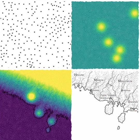
Different steps in the creation of a code-generated map that mimics real-world coastal landscape formation by erosion. Images by Martin O’Leary
There is no shortage of posts on maps here, but only one has been focused on the maps published in fantasy or fiction novels to set the scene. Two others have been linked to conservation, with one formatted in an amusing way. Then there’s my series on Icelandic cartography, starting in 1585 and continuing through 1849, then 1875, and finally 1906. But this is the first I hear about realistic fantasy maps created every hour by a bot – or computer program – coded by glaciologist Martin O’Leary and then tweeted on Twitter. And you can even go through the steps yourself and create a map of your making on his website! Betsy Manson writes for NatGeo:
As you travel northeast along the shore of southern Nimrathutkam, the first town you’ll encounter is Ak Tuh, followed by Nunrat and Nrik Mah before you reach the coastal city of Tuhuk, the largest urban area in the region of Mum Huttak.
If these sound like places out of a fantasy novel you read as a teenager, you’re not far off. Nimrathutkan is the result of an automated map generator that was inspired by those novels. The map bot, created by glaciologist Martin O’Leary of Swansea University in Wales, combines imaginary place names with fake terrain to produce fantasy worlds, tweeting a new one every hour from the Twitter account @unchartedatlas.
