When I first set foot in Croatia more than two decades ago it was for a project to assist the country in defending the coastal areas from the pressures of mass tourism development. Within a couple of years I was doing similar work in Montenegro. Before too long we were enough in love with the region to make it our family’s home for a year.
“[An] elegantly layered exploration of Europe’s past and future . . . a multifaceted masterpiece.”—The Wall Street Journal
“A lovely, personal journey around the Adriatic, in which Robert Kaplan revisits places and peoples he first encountered decades ago.”—Peter Frankopan, author of The Silk Roads
In this insightful travelogue, Robert D. Kaplan, geopolitical expert and bestselling author of Balkan Ghosts and The Revenge of Geography, turns his perceptive eye to a region that for centuries has been a meeting point of cultures, trade, and ideas. Continue reading →
Exactly 500 years ago, in August of 1519, an expedition led by the Spanish explorer Hernando Cortés began marching inland into Mexican territory. Just two years later, what today is Mexico City fell to an ethnically diverse army composed of both Spanish and local peoples from other cities, starting a long period of European colonization. This exhibition aims to expand our perspective on these events by featuring a selection of maps, known as Mapas de las Relaciones Geográficas, created by Indigenous artists around 1580. These unique documents show some of the visual strategies used by native communities for the endurance and perseverance of their cultures throughout the so-called colonial period and well beyond.
The Mapping Memory exhibition in at the Blanton Museum of Art in Austin, Texas, displays maps made in the late 1500s of what is now Mexico. They were created by indigenous peoples to help Spanish invaders map occupied lands. This watercolor and ink map of Meztitlán was made in 1579 by Gabriel de Chavez. Blanton Museum of Art
Pedro de San Agustín created this watercolor map of Culhuacán in 1580. He was a judge — a powerful figure in the town. “Before the conquest, nobles were the only ones trained as painters,” exhibit curator Rosario Granados explains. She notes that this map is made on bark paper, the traditional material used before the Spaniards arrived. Blanton Museum of Art
At the Blanton Museum of Art in Austin, Texas, 19 maps, nearly 440 years old, are on display — and they look spectacular. “Works on paper are delicate so we’re only allowed to put them on display for nine months out of 10 years,” says Blanton Museum communications director Carlotta Stankiewicz.
The Mapping Memory exhibition contains work by indigenous mapmakers from the late 1500s. The maps demonstrate a very different sense of space than maps drawn by Europeans. They’re not drawn to scale; instead, they’re deeply utilitarian.
A map of Culhuacán, for example, shows rivers running straight, with tiny arrows in the middle, indicating which way they flow. The pathways curve like snakes, with footprints or hoofprints indicating whether the paths can be walked or ridden. Continue reading →
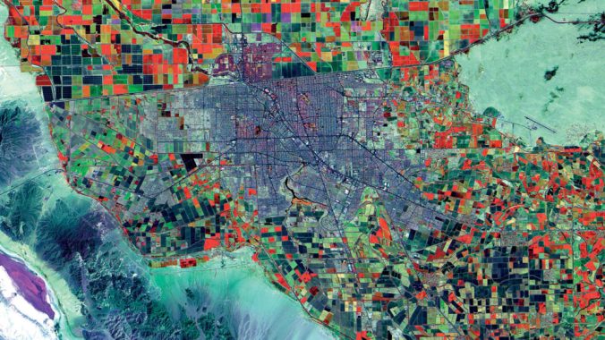
The world’s cities are expected to grow by another 2.5 billion people by 2050. A new collection of satellite images starkly illustrates the sheer size and imprint of the world’s urban centers and their vulnerability in the face of population growth and climate change.
February 10, 1977. Population 43,000. LANDSAT OLI/TIRS
Driven by rapid economic expansion and global trade, the world’s urban population has more than quintupled since the mid-20th century, from 751 million people in 1950 to 4.2 billion today. Centuries-old cities have pushed upward and outward to accommodate the influx of people, and entirely new megacities, home to tens of millions, have sprung up.
February 7, 2016. Population 10.8 million. LANDSAT OLI/TIRS
Nowhere can this swift urban growth be seen as vividly as from space. In their new book City Unseen, geographers Karen C. Seto and Meredith Reba, experts in urbanization and global change, offer a collection of satellite images from all seven continents that exhibit the massive imprint these cities have on the landscapes around them.
“If you look at images of Las Vegas and Lagos and Shenzhen, you see how much land it takes to house billions people, and it’s astonishing,” Seto, a professor of geography and urbanization science at the Yale School of Forestry & Environmental Studies, says. “But the impact of urbanization is not only the direct land these people live on. It’s all these other non-urban places where we need to extract resources to house and electrify, to operate these cities. That’s part of the story too.” Continue reading →
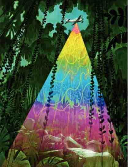
The jungle is constantly changing. Large mammals break through low growing plants, fungi break down fallen material, and birds, insects, and monkeys are constantly roaming about the canopy.
The most recent edition of the Chan Chich trail map was produced in 2006. However, since then, the wildlife has continued to go about its business making small modifications to the landscape over the past eleven years. Not to mention, the occasional tree fall from storm interrupting the balance. As a result, because of the organic, unpredictable movement of nature, this map isn’t as accurate as it was a decade ago. Now, Alana and I undertaking the task of updating the maps to reflect how the trails look now.
Congee, also known as jook, or rice gruel, has long been the breakfast of billions in China — filling, cheap, energizing, and easily digestible, fit for infants and nonagenarians alike. Some swear by it as a post-exercise pick-me-up; others as a superb hangover cure. Its soothing properties are considered so powerful that congee is even served at funerals. Continue reading →
Tasman Lake, which is fed by melt water from the retreating Tasman Glacier. Photo by Trevor Chinn
The kiwis referred to here are cute, small, fluffy, brown birds, not to be confused with small fuzzy brown fruit nor with the people who live in New Zealand. These flightless and nocturnal birds used to be divided in three to five species, but new DNA evidence from extensive blood sampling conducted over the last couple decades in their island home is indicating that there is in fact much more genetic diversity – which is often separated geographically – than previously thought, perhaps even enough to declare new species, or at the very least certainly new subspecies. And this might affect conservation strategies for these birds, which are all either endangered or vulnerable to endangerment. Ed Yong reports:
Several million years ago, a small bird flew to New Zealand. Arriving there, it found few threats and plenty of opportunities. In the absence of mammals, its descendants gradually lost the ability to fly, as island birds are wont to do. They also evolved to fill those niches that mammals typically occupy, rootling around the leaf litter in search of worms and grubs. They transformed into that icon of New Zealand—the adorable, bumbling kiwi.
A new geolocation system is helping people get around in places where the streets have no name. PHOTO: Mapcode
Rely on numbers to get around the neighbourhood? Then this one’s for you. A nonprofit called the Mapcode Foundation, has designed a system that assigns a unique and easily remembered address to any spot on the planet, without reference to landmarks or street names. Mapcodes consist of between four and nine digits and letters, which correspond to a five-square-metre patch on land or sea. Vowels have been eliminated from the system—so that mapcodes would not look like words, and because “O”s and “I”s cause confusion—but the remaining Latin consonants can be replaced with characters from the alphabets of most major languages. And the addresses are largely sequential: take a few steps in any direction and you’re in another square with a similar mapcode.
New research challenges stereotypical views of Tibet as an isolated and inward-looking society before the British and Chinese arrived. PHOTO: Maxi Science
Tibet. It’s called the ‘Roof of the World’ with good reason — the Tibetan Plateau stands over 3 miles above sea level and is surrounded by imposing mountain ranges that harbor the world’s two highest summits, Mount Everest and K2. While the world’s mountaineers regularly attempt to summit the forbidding peaks, the remote area is home to a rich variety of cultures. Less well-known is the story of how the Tibetan Plateau and the craggy peaks that surround it formed. The geologic tale is familiar to many schoolchildren: About 50 million years ago, the Indian subcontinent began to collide with Eurasia, and as it slammed into the bigger landmass, the plateau and the Karakoram and Himalaya ranges were born.
Only recently did Tibetan scholar Lobsang Yongdan revisit a long-ignored section of a historic text to reveal how Tibetans were engaging with western scientific knowledge two centuries ago. His research into a geography of the world, first published by a lama (Buddhist spiritual leader) in 1830, challenges stereotypical views of Tibet as an isolated and inward-looking society.
Sharavathi Railway Bridge is the longest railway bridge in the state of Karnataka. The Konkan railway crosses the Sharavathi river over this picturesque route. Continue reading →
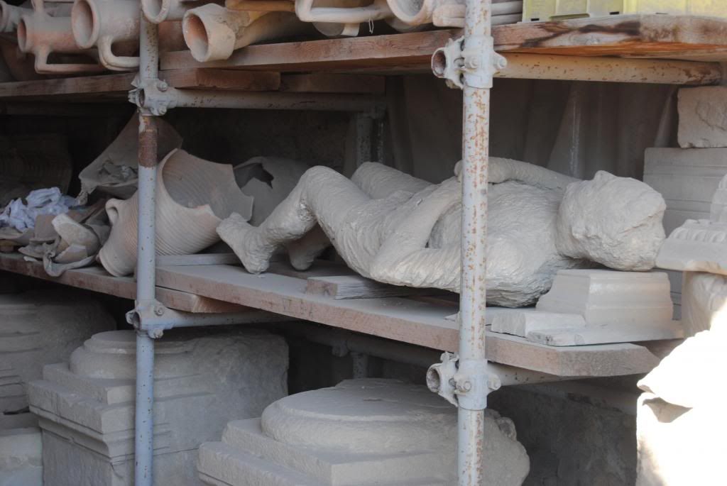
In 79AD, Mt. Vesuvius erupted with disastrous consequences for the residents of nearby Pompeii, Herculaneum, and other cities in the Campania region. Flows of boiling mud and rock rushed down the slopes, clouds of noxious fumes billowed upwards in the wind, and thousands of tons of rock and ash rained down upon the countryside. Pliny the Younger saw the eruption and likened it to a pinus, a pine tree. This may baffle some American readers, who may be accustomed to see pine trees that taper from a wide base to a narrow point Continue reading →
The view from the Anayirankal dam is one of the most popular excursions points in Idukki district. Situated near Munnar en route to Thekkady on the Munnar state highway, the dam is flanked by steep hills and tea plantations, making it a tranquil and scenic picnic spot. Continue reading →
Ooty is the most popular hill station in South India, lying in the Nilgiri mountains in the Indian state of Tamil Nadu. Located in the Western Ghats at a height of 2500 meters, Ooty is poetically called the “Queen of Hill stations Picturesque.” Dense jungles, huge inviting lakes, towering mountains, lush greenery and rambling tea gardens make up the landscape. Continue reading →
This is the story of two continents doing battle, North America versus South America. It is also a biological mystery.
For a very long time, North America and South America were separate land masses. The Pacific Ocean slipped between them, flowing into the Caribbean. The Isthmus of Panama was there, but it was underwater. The two continents didn’t touch.
As a result animals on both continents, especially mammals, evolved independently. They didn’t, couldn’t, interbreed. And yet, both North and South America had mountains, plains, long lazy rivers, deltas and supported similar forms of mammalian life. In fact, when biologists look back at the fossils, they found almost mirror like populations. Continue reading →
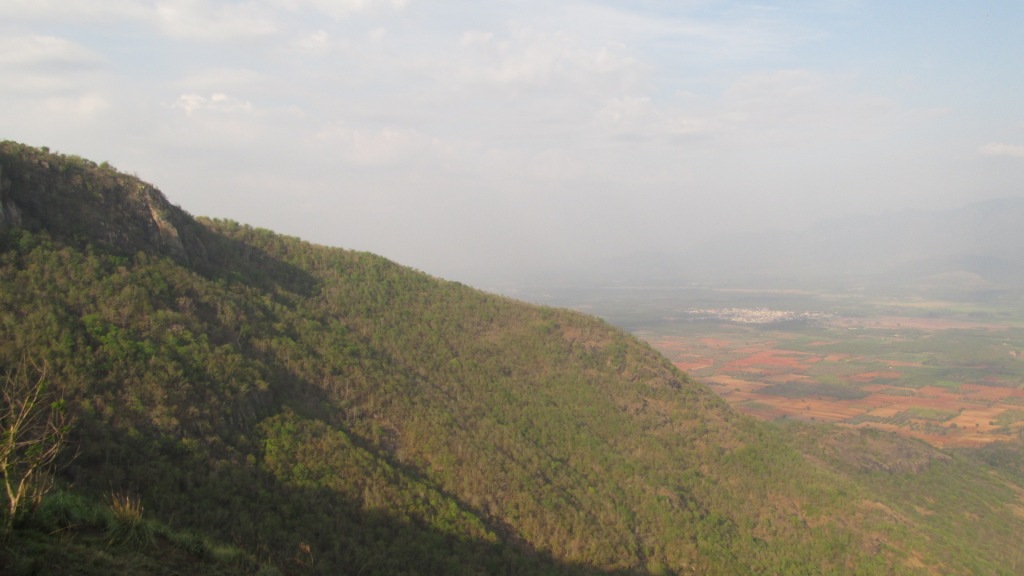
Skandagiri Hills is located near the town of Chickballapur, in the Indian state of Karnataka. Skandagiri Hills is very famous for its night trekking, and consequently, can be a trekker’s paradise during an evening with a full moon. Part of the allure of a Skandagari trek is with the high altitude one feels to be “walking above the clouds.” Additionally, there is a small temple stationed on top of the hill that is worthy of a visit. Continue reading →
Situated about 14 km from Thekkady on the Munnar road, Chellar Covil has one of the best overlooks from the heights of Kerala into Tamil Nadu. The sleepy little hamlet offers a breathtaking view of the plains and cascading waterfalls of the neighboring state. Continue reading →
Malcolm Gladwell brings to our attention an economist/planner/idea guy who might not otherwise have found his way to our reading list. In his usual writing style, Gladwell makes the man, by reviewing his biography, irresistible. Toward the end of the review, what is described as one of the economist’s key contributions provides a perfect counterpoint to these ideas. We like this guy because he chooses voice over exit (click the image to the right and it is definitely worth reading to the end):
In the mid-nineteenth century, work began on a crucial section of the railway line connecting Boston to the Hudson River. The addition would run from Greenfield, Massachusetts, to Troy, New York, and it required tunnelling through Hoosac Mountain, a massive impediment, nearly five miles thick, that blocked passage between the Deerfield Valley and a tributary of the Hudson. Continue reading →
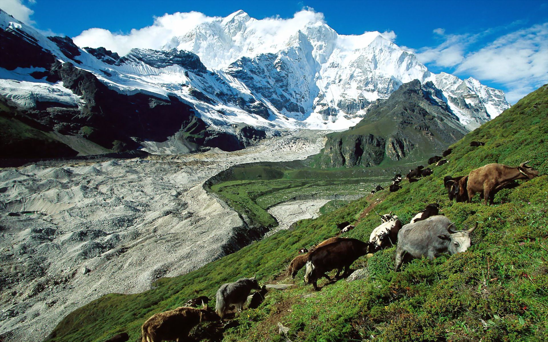
India Ink has a story about a group of young Indians collaborating in the upper reaches of the region’s mountains, at a time when many are celebrating the six decades-old historic accomplishment in the same region:
KHUMBU GLACIER —It was nearly 60 years ago this month that Tenzing Norgay, the Sherpa guide, and Sir Edmund Hillary from New Zealand scaled the highest peak in the world, Mount Everest. Continue reading →
Another great article (click the image to the left to go to the source), complementing this recent one from the New Yorker, about one special location within the region several members of Raxa Collective have called home for most of the last two decades:
The rain forests of Mosquitia, which span more than thirty-two thousand square miles of Honduras and Nicaragua, are among the densest and most inhospitable in the world. “It’s mountainous,” Chris Begley, an archeologist and expert on Honduras, told me recently. “There’s white water. There are jumping vipers, coral snakes, fer-de-lance, stinging plants, and biting insects. And then there are the illnesses—malaria, dengue fever, leishmaniasis, Chagas’.” Nevertheless, for nearly a century, archeologists and adventurers have plunged into the region, in search of the ruins of an ancient city, built of white stone, called la Ciudad Blanca, the White City. Continue reading →
The consistently superb essayist Adam Gopnik, who often writes about topics unrelated to the themes of our blog, in this week’s New Yorker writes on a topic close to our heart (click the image above to go to the article, subscription required):
Magazines in their great age, before they were unmoored from their spines and digitally picked apart, before perpetual blogging made them permeable packages, changing mood at every hour and up all night like colicky infants—magazines were expected to be magisterial registers of the passing scene. Yet, though they were in principle temporal, a few became dateless, timeless. The proof of this condition was that they piled up, remorselessly, in garages and basements, to be read . . . later. Continue reading →
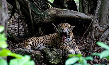
A jaguar – a symbol of Mayan royalty – is endangered but roams free in the Maya Biosphere Reserve, Guatemala. Photograph: Larry Larsen/Alamy
We make frequent links and comment on topics meant to raise awareness about innovative, fun and sometimes loony efforts—from the humble to the grand– to avert environmental collapse. The dangers are real enough that we assume readers get enough of the doom and gloom elsewhere, so that we can focus our efforts on evidence of potential solutions, and encourage collective action.
The photo above accompanies a story in the Guardian worth a read, to put in perspective why it is that the Mayan calendar doomsdate hoopla, or at least some of the accompanying history, was worth a bit of attention:
…Today, much of the Mayans’ ancient homeland is a 7,700-square mile protected area in Guatemala called the Maya Biosphere Reserve. With an area greater than the states of Connecticut and Rhode Island combined, the reserve protects the largest remaining forest in Central America. Beneath the canopy, monumental vestiges of temples and palaces attest to past splendour. Similar magnificence is found in the reserve’s wildlife. The jaguar, once a symbol of Mayan royalty, still roams free in one of Central America’s last wild places. Continue reading →
 When I first set foot in Croatia more than two decades ago it was for a project to assist the country in defending the coastal areas from the pressures of mass tourism development. Within a couple of years I was doing similar work in Montenegro. Before too long we were enough in love with the region to make it our family’s home for a year.