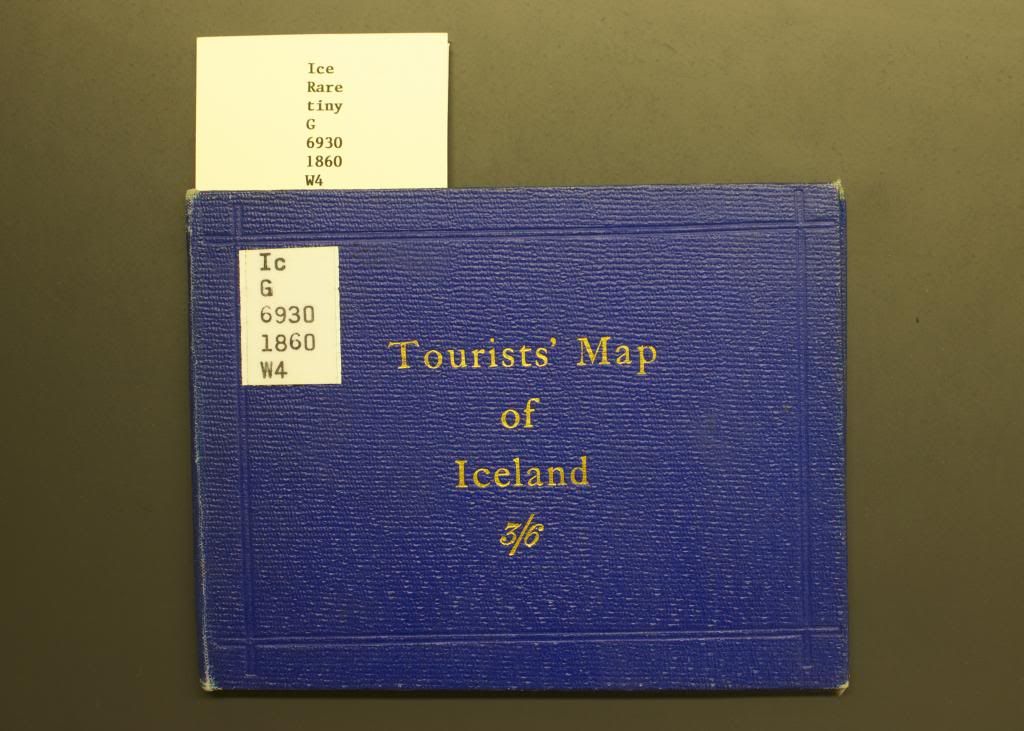
Tourists’ Map of Iceland by Edward Weller
Although the paper documentation on this item give the date as 1860, when I looked at the map last week I noticed a discrepancy that made such a date of publication impossible. It’s all thanks to William Watts and his expeditions across the nice blank spot in the south-east corner of the island. When he crossed the Vatna Jökull, Watts helped add several landmarks to that white blotch (which, remember, was still in Gunnlaugsson and Ólsen’s 1849 “complete” map of Iceland) and clearly at least one cartographer decided to plot Watts’ course in a published edition, perhaps because the map was expressly intended to be used by travelers in the country. The Tourists’ Map of Iceland, labeled ‘tiny’ in the item documentation given the little booklet’s 12 x 15 cm (4.7 x 5.9 in) dimensions, is perfectly pocket-sized, and folds out into the 19 x 26 cm map pictured below.

Written by a small dotted line across the ‘Vatna Jökull or Klofa’ space are the words, “Crossed by Mr. W.L. Watts 1875.” Clearly, this map couldn’t have been published in or around 1860, but somewhere closer to the period just after 1875. But the publication-date mystery doesn’t end here.
If you look under the map title in the bottom left corner, you can see a penned signature of one “Fredc. Brine, Col. R.E.” (“Fred. Brine” is also written in pencil on the lower left margin of the paper as part of library documentation). I took this to mean ‘Frederic Brine, Colonel in the Royal Engineers’, since I had seen similar abbreviations for members of the Royal Navy (R.N.) and indeed typing this name and title into Google reveals there was such a person in the service of Britain’s military forces, according to The New Annual Army List, Militia List, and Yeomanry Cavalry List, and The New York Times August 3, 1902 issue. While the Cornell Library online catalogue system (now corrected to “ca. 1875” instead of “ca. 1860” after I pointed out the Watts issue) credits Edward Weller with the map above (peer into the lower right corner of the map border and you’ll see his name there), with a little more digging I found that the Royal Geographical Society advertised a new map by Col. Frederick Brine, R.E. in its Proceedings and Monthly Record of Geography of 1881, vol. 3, which throws some doubt on what’s what. The original Cornell Library catalogue record of the item, compiled by Halldór Hermannsson in 1914, also attributed the map to Brine, but the “n.d.” in the record presumably signifies “no date,” which means the information must have been entered some time later.
Now, of all the maps that I have looked at this one is probably the least important since it was almost certainly based on Gunnlaugsson‘s or Thoroddsen‘s work and I haven’t read of anyone using Weller’s/Brine’s map, so I won’t go to the ends of the earth to learn the actual publication date and author, but I do plan on checking in with the curator of Cornell’s Icelandic collection to see what he thinks.

Pingback: If You Happen To Be In New York City |
Pingback: Library, Guardian Of Spiritual Treasure |
Pingback: If You Happen To Be In Denmark |
Pingback: If You Happen To Be In New York City | Raxa Collective