Adaptation’s Appetite

merlin_138614541_c4902893-8458-4d2d-ab11-fa10c796102c-jumbo

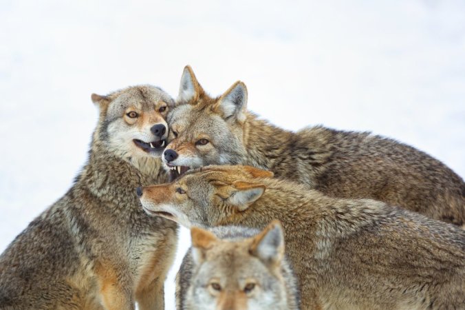
“They have to be one of the most adaptable animals on the planet,” said one ecologist who studies coyotes. Credit Perry McKenna/Getty Images

On this platform we have been in favor of celebrating conservation rather than doomsday. Science is key, but we also think entrepreneurship can be harnessed in the right direction, publicly and privately. There is not much to celebrate in the following story. The animals in the photo above, without any further details, could be granted wild beauty status. But context is everything. So we celebrate the writers who illuminate important scientific ideas, and their stories. Thanks to JoAnna Klein, who we have linked to many times (but missed this related recent story) for providing those details:

Coyotes Conquered North America. Now They’re Heading South.

New maps seek to update the historical range of our continent’s toughest canids, which have thrived as other predators experienced decline.

merlin_138614523_660b4fa1-90b1-49ed-8678-6322959a59e1-jumbo

A coyote crossing U.S. Highway 120 near Groveland, Calif. Credit Justin Sullivan/Getty Images

Coyotes are excellent colonizers.

They breed fast, eat almost anything and live just about anywhere. You can find them in fields, forests, backyardsparks and even parking decks. They’re living in cities like Los AngelesNew York and Chicago. They’ve even made it to the Florida Keys and Long Island. In 2010, they crossed the Panama Canal. Now, the only thing keeping them from entering Colombia is a dense patch of forest called the Darien Gap. And camera traps have caught them heading that way. Continue reading

Plastic Reduction Success Story

5150 (1).jpg

A UK levy of 5p per bag introduced in 2015 has already reduced single-use plastic bags by 85%. Photograph: Stuart Kelly/Alamy Stock Photo

We never tire of reporting on efforts at plastic-reduction, so thanks to Juliette Jowit and the Guardian for this update:

Drop in plastic bags littering British seas linked to introduction of 5p charge

Scientists find an estimated 30% drop in plastic bags on the seabed in the same timeframe as charges were introduced in European countries

A big drop in plastic bags found in the seas around Britain has been credited to the introduction of charges for plastic bags across Europe. Continue reading

Maps, Walking & Health

Emily has been reworking the maps for nine miles of walking trails surrounding Chan Chich Lodge. On a typical day I walk 45 minutes at dawn, and 45 minutes at dusk and I have tended to stay on the same trail for the last year. Now I am looking forward to the various loops I had not yet wandered onto, and checking the maps. I tend to believe in the link between nature and health, and especially when walking is involved the benefits are a broader form of wellbeing. Gretchen Reynolds, writing the Phys Ed column for the New York Times has this to say:

For Exercise, Nothing Like the Great Outdoors

Long walks can improve moods and reduce anxiety, but the benefits may be greatest if the walks take place outdoors rather than in a gym, according to a new study by researchers in Austria. And while the Alps may be a particularly fine place to hike, a vigorous walk in the woods or paths near home may provide the mental boost we need to keep us moving.

We all know, by now, that for optimal health, we need to move. Continue reading

America’s Best Idea Just Got Better

In our current political climate we continue to applaud those who stand up for science, nature and culture. It’s been particularly heartening to watch the steward’s of our national parks create a virtual protective shield around the vision they’re charged to protect.

My personal standing ovation goes to the partially anonymous park ranger who spends his spare time creating downloadable maps of all our country’s national parks, by state, from A to Z. (F, Q, U and X seem to be the only letters missing…) In addition to maps, site visitors find all sorts of experiential tips to prepare for safe exploration.

Glacier Maps

If you’re looking for a Glacier map, you’ve come to the right place; currently I’ve collected 28 free Glacier National Park maps to view and download. (PDF files and external links will open in a new window.) Here you’ll find a bunch of trail maps, along with other maps such as campgrounds and the shuttle bus. You can also browse the best-selling Glacier maps and guidebooks on Amazon. Continue reading

Top Shelf Infographics For 128 Years

phpthumb_generated_thumbnailjpg

Thanks to the fancy-fine publisher, Taschen, for collecting this particularly powerful informative art form into one book:

A History of Knowledge

The best infographics from the National Geographic archives

Back in the days when the information age was a distant dream and the world a more mysterious place, National Geographic began its mission to reveal the wonders of history, popular science, and culture to eager audiences around the globe. Since that 1888 launch, the world has changed; empires have risen and crumbled and a galaxy of information is today only a click away. But National Geographic endures; its calm, authoritative voice is as respected as ever amid the surfeit of data in our daily lives. Continue reading

Bring Back The Green!

allegheny_custom-5d30decc2d7e48cf9bd714983a1d1d5d45b3d014-s1100-c85

The Allegheny National Forest is absent from Google Maps (right) but displayed on Apple Maps (left). Apple & Google/Screenshots by NPR

We lose more than enough green in the real world, so when the cartographical world starts compounding the problem, we must shout in protest:

Where Did National Forests Go? Green Spaces Disappear From Google Maps

Erin Ross

If you looked at Google Maps this week, you might have noticed something strange: less green. Continue reading

The History of America’s National Parks through Maps

03_gettysburg_battlefield-adapt-1190-1

A map depicting the three-day battle of Gettysburg. Source: Library of Congress

Later this week, on August 25th, will be the U.S. National Park Service centennial (more about that on the day in question). So for all history buffs out there, you might enjoy the following article by National Geographic that provides a historical context to several topographical maps of the national parks (a somewhat contrasting view to yesterday’s post on fictional map creation) and their uncharted contribution to historians many years later.

By Betsy Mason

CAMBRIDGE, Mass.—John Badger Bachelder arrived at Gettysburg before the soldiers’ bodies were buried. He spent the next 84 days studying the battlefield by horseback and filling notebooks with the accounts of injured soldiers from both sides of the battle. He even took some of the wounded back to the scene so they could point out their positions and recount what had happened.

Continue reading

Fantastic Fantasy Maps Generated By Code

Different steps in the creation of a code-generated map that mimics real-world coastal landscape formation by erosion. Images by Martin O’Leary

There is no shortage of posts on maps here, but only one has been focused on the maps published in fantasy or fiction novels to set the scene. Two others have been linked to conservation, with one formatted in an amusing way. Then there’s my series on Icelandic cartography, starting in 1585 and continuing through 1849, then 1875, and finally 1906. But this is the first I hear about realistic fantasy maps created every hour by a bot – or computer program – coded by glaciologist Martin O’Leary and then tweeted on Twitter. And you can even go through the steps yourself and create a map of your making on his website! Betsy Manson writes for NatGeo:

As you travel northeast along the shore of southern Nimrathutkam, the first town you’ll encounter is Ak Tuh, followed by Nunrat and Nrik Mah before you reach the coastal city of Tuhuk, the largest urban area in the region of Mum Huttak.

If these sound like places out of a fantasy novel you read as a teenager, you’re not far off. Nimrathutkan is the result of an automated map generator that was inspired by those novels. The map bot, created by glaciologist Martin O’Leary of Swansea University in Wales, combines imaginary place names with fake terrain to produce fantasy worlds, tweeting a new one every hour from the Twitter account @unchartedatlas.

Continue reading

Bad News for the Night Sky

Credit: The authors of the manuscript. Prepared by Fabio Falchi

It is unsurprising to learn that light pollution has increased in the fifteen years since the first global map tracking the spread of artificial lumens, but disappointing to hear nonetheless. Last week we posted about one downside to lights in the dark, two years ago shared the idea of “dark sky parks,” and four years ago linked to an initiative to reduce light pollution. Carl Engelking writes for the Discover Magazine blog on the new atlas of the night sky:

The beauty of the night sky is rapidly fading, and an update to the first global light pollution map, created 15 years ago, makes that painfully clear.

The new atlas revealed that more than 80 percent of the world lives under light-polluted skies – that rises to 99 percent of the population in the United States and Europe. One-third of humanity can no longer see the Milky Way. As the new map shows, the night sky is slowly retreating to the glow of artificial light.

Continue reading

You Are Here

You Are Here.

Three small words found on map boards from metros to malls around the world, usually accompanied by a red dot. Existential words to be sure. Words whose underlying message begs us to live with intention.

The RAXA Collective team crafted the Xandari Harbour walking map with the same deliberateness.

Come explore with us!

Step out from Xandari Harbour’s red door. Go right. Go left. You can’t go wrong!


click below to view the map!

Continue reading

Feathers’ Maps Rediscovered

Map

Thanks to the Atlantic‘s website for this Editor’s Pick, a fascinating video about a map collection and its conservation:

‘A Hidden Treasure’: The Unusual Story Behind a Rare Map Collection

Video by Alec Ernest

In this short documentary produced for the Los Angeles Review of Books, Alec Ernest digs into the story behind an extraordinary private collection of maps discovered by Glen Creason, a librarian.

Continue reading

If You Happen To Be In New York City

04-nypl-580

It has been a while since we have seen any old maps of Iceland, or old images of anything for that matter, so combined with a few select Raxa bloggers receiving a near-final copy of Seth’s honors thesis for review a few moments ago, this announcement came as a pleasant surprise:

Last week, the New York Public Library released twenty thousand maps from its extensive collection, which includes more than four hundred thousand sheets and twenty thousand books and atlases, as free, high-resolution digital downloads. In announcing the newly accessible maps, the N.Y.P.L explained that the holding includes more than a thousand maps of New York City from the seventeenth century to the twentieth century, “which detail transportation, vice, real estate development, urban renewal, industrial development and pollution, political geography among many, many other things.” Continue reading

Maps, More Than A Practical Tool

Map of Treasure Island, from Robert Louis Stevenson’s “Treasure Island.”

Map of Treasure Island, from Robert Louis Stevenson’s “Treasure Island.”

Travel without a map can be fun, sometimes, if adventure is the objective; but context and direction helps more than it hurts most of the time. The same is true when maps are there just for the sheer pleasure or comfort, in environmentally sensitive, creative graphic design, or for historical research. This post on the New Yorker‘s website captures the sentiment well:

For years, I carried the same map wherever I went. When I wasn’t travelling, Scotch Tape held it to the back of my bedroom door: it was visible to me when the door was closed, but invisible to almost everyone else. That map moved from dorm rooms to apartments and houses, from the Eastern Shore of Maryland to New England, from New England to the United Kingdom, and back again.

When I felt homesick, I would drag my fingers up and down the map’s paper folds, tracing its shorelines and rivers, wishing they were the real thing. But touching that map only made me more homesick. Continue reading

If You Happen To Be In New York City

New York University’s Institute For The Study Of The Ancient World is hosting an exhibition that speaks to those of us who love maps and the ideas they represent in historic as well modernistic terms. (GPS-guided navigation systems, we love you, but this is about your ancestors). Those ideas can be as simple as “Getting From Here To There, In Hindsight,” which might have been a subtitle to this exhibition:

Measuring and Mapping Space will explore the ways in which ancient Greek and Roman societies understood, perceived, and visualized both the known and the unknown areas of their world. It brings together more than forty objects, combining ancient artifacts with Medieval and Renaissance manuscripts and printed books that draw upon ancient geographic treatises. Together, they provide a fascinating overview of Greco-Roman theories of the shape and size of the Earth, ancient methods of surveying and measuring land, and the ways in which geography was used in Roman political propaganda. A specially designed multimedia display examines the increasing importance of modern technologies in mapping the ancient world. Continue reading

Icelandic Cartography: Thoroddsen

This tiny thumbnail is all the American Geographical Society Library will let you download from their digital map collection, but if you click on the photo you’ll be routed to the University of Wisconsin’s Milwaukee Libraries Digital Collections page and have access to the map in stupendously high resolution, with the capability to zoom in and move around Þorvaldur* Thoroddsen’s 1901 Geological Map of Iceland; Surveyed in the years 1881-1898. This version was published in English at Copenhagen, but I have featured the 1906 version before, and keep a printed copy of the later publication (publ. Gotha, Germany), hanging in my room in Ithaca.

I use my copy for any quick reference I need to make while reading or thinking about places in Iceland for my research, and I also plan on starting to use little ball pins to mark down the most often-traveled areas and more quickly become accustomed with place-names and distances between locations. One interesting difference between the 1901 English and 1906 German versions of this map is the Vatna/Klofa Jökull region, which Continue reading

Icelandic Cartography: ca. 1875(?)

Tourists’ Map of Iceland by Edward Weller

Although the paper documentation on this item give the date as 1860, when I looked at the map last week I noticed a discrepancy that made such a date of publication impossible. It’s all thanks to William Watts and his expeditions across the nice blank spot in the south-east corner of the island. When he crossed the Vatna Jökull, Watts helped add several landmarks to that white blotch (which, remember, was still in Gunnlaugsson and Ólsen’s 1849 “complete” map of Iceland) and Continue reading

Icelandic Cartography: 1849

Uppdráttr Íslands / Carte d’Islande by Björn Gunnlaugsson and Ólafs Nicolas Ólsens, 1849.

Björn Gunnlaugsson was an Icelandic cartographer who along with the Danish army cartographer Ólafs Ólsen is credited with the first complete map of Iceland, even though the ever-present “Vatnajökull eða Klofajökull” space in the south-east was still blank. The Icelander received the Danish Order of the Dannebrog and the French Légion d’honneur for his surveying work, but the map was published under Ólsen’s name in Denmark, so future travelers would constantly refer to the “invaluable Olsen’s map” as essential to their expeditions around the country. Continue reading

Icelandic Cartography: 1585

Islandiamap_zps29f97df9.jpg

A 1585 copy of Islandia, by Abraham Ortelius (1527-1598)

One of my favorite things about the Rare & Manuscripts Collection in the basement of Cornell’s Kroch Library is that I can request to look at documents like this one, over four-hundred years old, and nobody comes and says, “Excuse me, but you’re a bit young to be doing that, aren’t you?” Granted, this old map was in a picture frame, so relatively speaking I wasn’t handling as preciously fragile a document as most of our other pieces from the 16th century are (the type that require white cloth gloves), but I still felt a lot of responsibility as I cautiously Continue reading

The Upsides Of Downside Exploration

The Shinkai6500 deep-sea submersible

The Shinkai6500 deep-sea submersible. Photograph: Jon Copley

Told in the first person, we appreciate Jon Copley’s account of his most recent amazing work, and the Guardian’s coverage of it:

Five kilometres, or 3.1 miles, is not a great distance on land – the length of a pleasant stroll. But five kilometres vertically in the ocean separates different worlds. On 21 June I had the opportunity to make that short journey to another world, by joining Japanese colleagues for the first manned mission to the deepest known hydrothermal vents, five thousand metres down on the ocean floor. Continue reading