Thanks to Jim Robbins and Yale e360:
CRISIS ON THE COLORADO: PART I
The West’s Great River Hits Its Limits: Will the Colorado Run Dry?
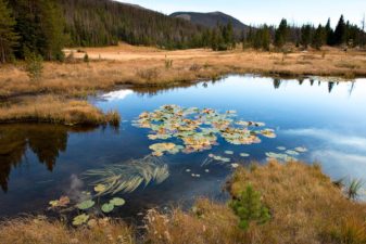
The headwaters of the Colorado River are in a marshy meadow in Rocky Mountain National Park.
As the Southwest faces rapid growth and unrelenting drought, the Colorado River is in crisis, with too many demands on its diminishing flow. Now those who depend on the river must confront the hard reality that their supply of Colorado water may be cut off. First in a series.
The beginnings of the mighty Colorado River on the west slope of Rocky Mountain National Park are humble. A large marsh creates a small trickle of a stream at La Poudre Pass, and thus begins the long, labyrinthine 1,450-mile journey of one of America’s great waterways.
Several miles later, in Rocky Mountain National Park’s Kawuneeche Valley, the Colorado River Trail allows hikers to walk along its course and, during low water, even jump across it. This valley is where the nascent river falls prey to its first diversion — 30 percent of its water is taken before it reaches the stream to irrigate distant fields.
The Colorado flows 1,450 from its source in Colorado to the southwest, ending just short of the Gulf of California. MAP BY DAVID LINDROTH
The Never Summer Mountains tower over the the valley to the west. Cut across the face of these glacier-etched peaks is the Grand Ditch, an incision visible just above the timber line. The ditch collects water as the snow melts and, because it is higher in elevation than La Poudre Pass, funnels it 14 miles back across the Continental Divide, where it empties it into the headwaters of the Cache La Poudre River, which flows on to alfalfa and row crop farmers in eastern Colorado. Hand dug in the late 19th century with shovels and picks by Japanese crews, it was the first trans-basin diversion of the Colorado.
Many more trans-basin diversions of water from the west side of the divide to the east would follow. That’s because 80 percent of the water that falls as snow in the Rockies here drains to the west, while 80 percent of the population resides on the east side of the divide.
The Colorado River gathers momentum in western Colorado, sea-green and picking up a good deal of steam in its confluence with the Fraser, Eagle, and Gunnison rivers. As it leaves Colorado and flows through Utah, it joins forces with the Green River, a major tributary, which has its origins in the dwindling glaciers atop Wyoming’s Wind River Mountains, the second largest glacier field in the lower 48 states.
The now sediment-laden Colorado (“too thick to drink, too thin to plow” was the adage about such rivers) gets reddish here, and earns its name – Colorado means “reddish.” It heads in a southwestern direction through the slick rock of Utah and northern Arizona, including its spectacular run through the nearly 280-mile-long Grand Canyon, and then on to Las Vegas where it makes a sharp turn south, first forming the border of Nevada and Arizona and then the border of California and Arizona until it reaches the Mexican border. There the Morelos Dam — half of it in Mexico and half in the United States — captures the last drops of the Colorado’s flow, and sends it off to Mexican farmers to irrigate alfalfa, cotton, and asparagus, and to supply Mexicali, Tecate, and other cities and towns with water.
While there are verdant farm fields south of the border here, it comes at a cost. The expansive Colorado River Delta — once a bird- and wildlife-rich oasis nourished by the river that Aldo Leopold described as a land of “a hundred green lagoons” — goes begging for water. And there is not a drop left to flow to the historic finish line at the Gulf of California, into which, long ago, the Colorado used to empty…

Read the whole story here.
