
After two decades of drought, Lake Mead in Nevada is just 40 percent full. TED WOOD
Thanks to Jim Robbins and Yale e360 for this second installment, and especially to Ted Wood for photography as visually compelling as the implication of the story:
CRISIS ON THE COLORADO: PART II
On the Water-Starved Colorado River, Drought Is the New Normal
With the Southwest locked in a 19-year drought and climate change making the region increasingly drier, water managers and users along the Colorado River are facing a troubling question: Are we in a new, more arid era when there will never be enough water?
Scientists at the University of Arizona are using tree rings to study centuries of drought conditions in the Colorado River Basin.
In the basement of the University of Arizona’s Laboratory of Tree-Ring Research, the fragrant smell of pine hangs in the air as researchers comb through the stacks of tree slabs to find a round, 2-inch-thick piece of Douglas fir.
They point out an anomaly in the slab — an unusually wide set of rings that represent the years 1905 to 1922. Those rings mean it was a pluvial period — precipitation was well above average — and so the trees grew far more than other years.
“In 1905, the gates opened and it was very wet and stayed very wet until the 1920s,” said David Meko, a hydrologist at the lab who studies past climate and stream flow based on tree rings. “It guided their planning and how much water they thought was available.”
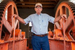
Mark Harris, a water manager in Grand Junction, Colorado.
The planning was that of the states that share the water of the Colorado River. Worried that a burgeoning California would take most of the water before it was fairly divvied up, representatives from the other Colorado River Basin states, presided over by U.S. Secretary of Commerce Herbert Hoover, came together in 1922 to develop an equitable apportionment. They looked at flow measurements and figured that the river contained an average of 15 million acre-feet. They divided the Colorado River states into two divisions – the upper basin and the lower basin, with the dividing line in northern Arizona near the Utah border. The upper basin states — Utah, Wyoming, Colorado, and New Mexico — agreed not to take more than a total of 7.5 million acre-feet and to allow the other half to flow south to the lower basin. The agreement they signed was called the 1922 Colorado River Compact, also known as the Law of the River.
The 1922 compact, though, is based on a premise that the tree rings in the University of Arizona lab now show is false. The river’s long-term average flow is about 12 to 15 million acre-feet, in a good year. Meanwhile, the lower basin states — Arizona, California, and Nevada — use 7.5 million acre-feet, and in 1922 no one factored in evaporative losses from the desert sun at the yet-unbuilt Lake Mead reservoir, which amount to another 1.2 million acre-feet, or the water taken up by plants. Nor did anyone factor in a subsequent 1944 treaty that requires the United States to provide 1.5 million acre-feet to Mexico. A conservative estimate on how much Colorado River water is actually used is 20 million acre-feet.
This over-appropriation is problem enough, but in recent years the river’s flow has been dwindling. The region is locked in a 19-year-long drought, the most severe in 1,250 years. And it may continue much longer. The tree ring data shows that there have been numerous multi-decadal or mega-droughts in the basin in the last 1,000 years. The prospect that drought could be the new normal for the region is creating a good deal of anxiety along the Colorado.
“Many water managers like me are struggling at not panicking,” said Mark Harris, general manager of the Grand Valley Water User’s Association in Grand Junction, Colorado. In his farm cap and jeans, Harris is a no-nonsense type, not given to hyperbole. This year, though, some “junior” water users on the Yampa River, a tributary to the Colorado, were told they would not get their water because others had priority, the first time that has ever happened, and late-season water flows near Grand Junction were near crisis levels. “The crunch is here,” Harris said. “It’s here, and it will stay here. We will never be out of the woods, we are in the woods forever.”…

Read the whole story here.
