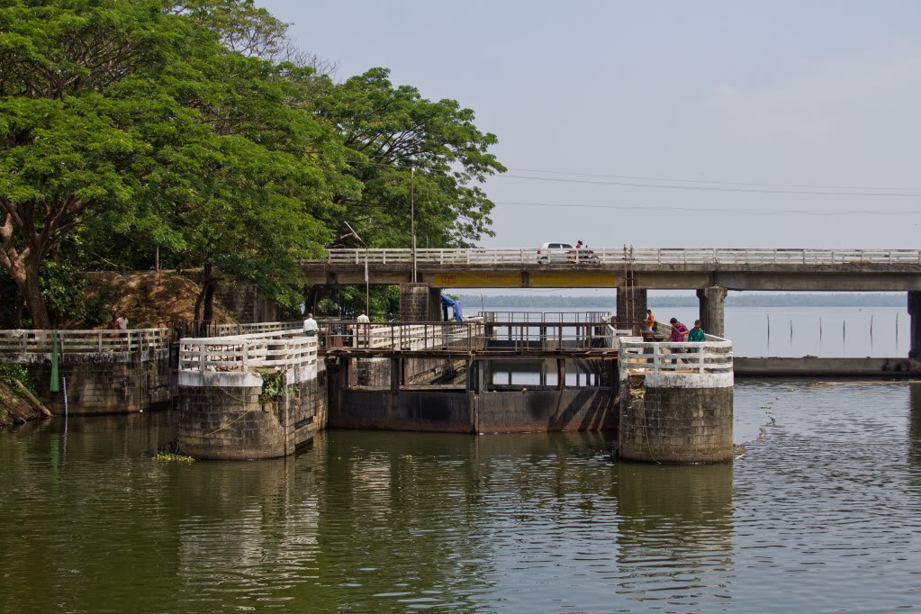
We were recently traveling by houseboat from Kumarakom across Lake Vembanad, the largest backwater in Kerala, toward Cochin and therefore the Arabian Sea. This route requires passing through the Thannermukkom Bund, the largest mud regulator in India.
This barrier essentially divides Vembanad in half – separating the brackish waters that flow from the Arabian Sea from the sweet river water that feeds into the lake. For six months a year the dike is left open, particularly during the monsoon season, but historically the gates are closed on December 15th to assist agriculture in the Kuttanad District, where farming is done below sea level.
Like many areas of the world with significant geographical elements that effect both country and culture, the watery landscape is defined as either north of the bund or south of it. These discriptors are as elemental as global coordinates for people in the region.
We’d made this journey from North to South last year when the gates were still open, but this second, opposite journey required negotiating with the gatekeepers in order to continue our passage.
Even without understanding a word of Malayalam the process was fascinating. Continue reading →