Historian Cross-overs

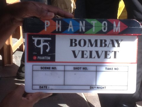
Photo: Gyan Prakash. A clapper board for the film “Bombay Velvet”.

For anyone who has been following Seth’s posts on this site over the last couple years, there has been a notably strong dose of history in many due to his decision to focus his undergraduate studies in environmental history. Summer 2013–an archival deep dive quite distinct from his previous summers in the present reality of Galapagos, Nicaragua, India, Jordan, Chile, Croatia, Costa Rica, France–was spent in Ithaca, his first summer there since the series of summers 1992-1995 (birth year through toddlerhood, when his father was engaged in history-based doctoral dissertation research). Is there a DNA tracer for history appreciation?

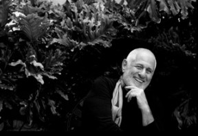
This comes to mind reading Gyan Prakash’s account of his experience mixing history and film.  For the many readers of university age who follow Seth’s writings the reasonable question might be what he plans to do with that degree once he graduates.  We expect that in the coming months as he approaches graduation this will start popping up as a theme in his posts. What good is history? Consult Mr. Prakash for inspiration:

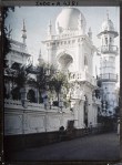
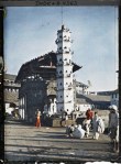
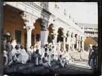
On July 28, I flew to Colombo, the capital of Sri Lanka, to join the filmmaker Anurag Kashyap,  the actors Ranbir Kapoor and Anushka Sharma, and a massive crew making the movie “Bombay  Velvet.” In 2004, drawing on my research on the history of Mumbai, I had written the outline for a retro film noir  aimed at capturing the momentous transformation of Mumbai’s milieu of jazz clubs and industrial society in the 1960s. Continue reading
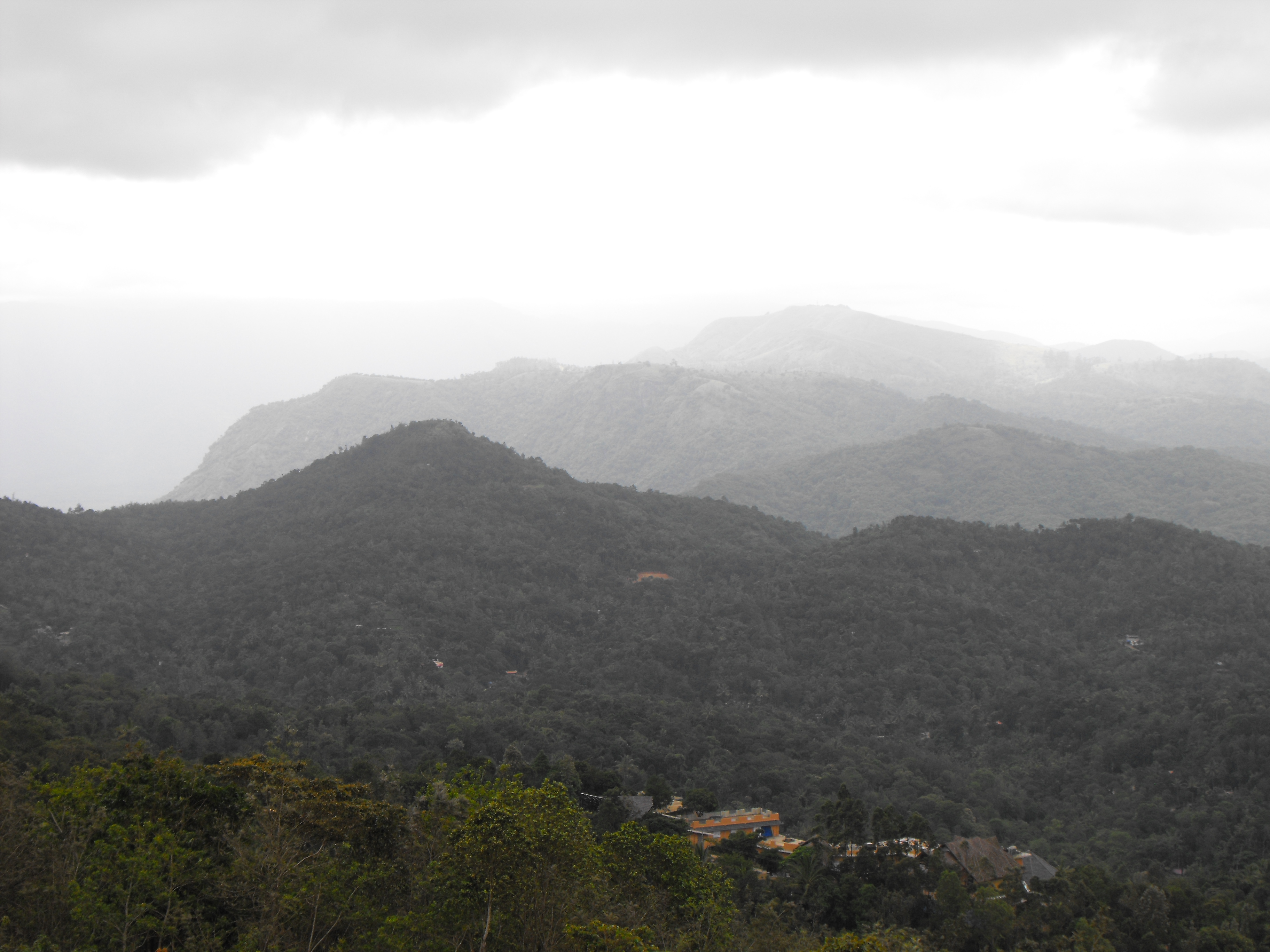
Icelandic Cartography: Thoroddsen

This tiny thumbnail is all the American Geographical Society Library will let you download from their digital map collection, but if you click on the photo you’ll be routed to the University of Wisconsin’s Milwaukee Libraries Digital Collections page and have access to the map in stupendously high resolution, with the capability to zoom in and move around Þorvaldur* Thoroddsen’s 1901 Geological Map of Iceland; Surveyed in the years 1881-1898. This version was published in English at Copenhagen, but I have featured the 1906 version before, and keep a printed copy of the later publication (publ. Gotha, Germany), hanging in my room in Ithaca.

I use my copy for any quick reference I need to make while reading or thinking about places in Iceland for my research, and I also plan on starting to use little ball pins to mark down the most often-traveled areas and more quickly become accustomed with place-names and distances between locations. One interesting difference between the 1901 English and 1906 German versions of this map is the Vatna/Klofa Jökull region, which Continue reading

Icelandic Cartography: ca. 1875(?)

Tourists’ Map of Iceland by Edward Weller

Although the paper documentation on this item give the date as 1860, when I looked at the map last week I noticed a discrepancy that made such a date of publication impossible. It’s all thanks to William Watts and his expeditions across the nice blank spot in the south-east corner of the island. When he crossed the Vatna Jökull, Watts helped add several landmarks to that white blotch (which, remember, was still in Gunnlaugsson and Ólsen’s 1849 “complete” map of Iceland) and Continue reading

Icelandic Cartography: 1849

Uppdráttr Íslands / Carte d’Islande by Björn Gunnlaugsson and Ólafs Nicolas Ólsens, 1849.

Björn Gunnlaugsson was an Icelandic cartographer who along with the Danish army cartographer Ólafs Ólsen is credited with the first complete map of Iceland, even though the ever-present “Vatnajökull eða Klofajökull” space in the south-east was still blank. The Icelander received the Danish Order of the Dannebrog and the French Légion d’honneur for his surveying work, but the map was published under Ólsen’s name in Denmark, so future travelers would constantly refer to the “invaluable Olsen’s map” as essential to their expeditions around the country. Continue reading

Icelandic Cartography: 1585

Islandiamap_zps29f97df9.jpg

A 1585 copy of Islandia, by Abraham Ortelius (1527-1598)

One of my favorite things about the Rare & Manuscripts Collection in the basement of Cornell’s Kroch Library is that I can request to look at documents like this one, over four-hundred years old, and nobody comes and says, “Excuse me, but you’re a bit young to be doing that, aren’t you?” Granted, this old map was in a picture frame, so relatively speaking I wasn’t handling as preciously fragile a document as most of our other pieces from the 16th century are (the type that require white cloth gloves), but I still felt a lot of responsibility as I cautiously Continue reading

Europeans And Indians, The Early Days

Screen Shot 2013-07-21 at 12.19.40 PM

In several past posts about historically interesting interactions between Europeans and Indians, the New World variation on that story was invoked to make a point, mainly with an eye toward environmental history. Today’s Hindu has an article that draws on the history contained in the journal to the left about (Old World) Vasco de Gama’s first experience in (Older World) India, specifically the Malabar Coast and what is now the state of Kerala. Click the image to go to the source of the book, and here to go to the Hindu article:

The hero of the first Portugese contact on Indian shores is a degradado, or Portugese convict and exile, not Vasco da Gama.

One of the greatest navigators from the Age of Discoveries, da Gama, appointed by Dom Manuel, King of Portugal, for his “energy and high spirits” refused to take the initiative to go ashore on the morning of May 21, 1498. Instead, da Gama chose to wait in the depths of his ship, Sao Gabriel, while the convict Joao Nunes stepped out into the monsoon showers off the western coast of Kozhikode to meet, much to his amazement, a pair of multi-lingual Tunisian merchants. Continue reading

National Geographic Over the Years

NatGeo’s magazine covers over the years, stitched together from individual photos I took at the National Geographic Museum in Washington, D.C.

As National Geographic celebrates its 125th year of journalism, it is interesting to see how small things, like the magazine covers and the information they conveyed, have changed. In the photo above, the November, 1960 issue (far left) was priced at $1.00; the July, 1954 issue (second from left) at 65¢; and from then backwards each magazine was a whopping 25¢. Today’s magazines don’t disclose their individual price, but a yearly subscription at $15 is not too shabby considering it was $8/yr in 1960, up from $6.50 in 1954.

The July, 1954 issue’s first featured article is titled, “Triumph on Everest,” and the last, “Everyone’s Servant, the Post Office”; July, 1898 (far right in the photo above), on the other hand, saw “American Geographic Education” and “The Geologic Atlas of the United States” as the first and last articles.

Continue reading

Exploring My New Surroundings

Mountain ridge border between Kerala and Tamil Nadu

Mountain ridge border between Kerala and Tamil Nadu

This past weekend I was able to explore the surrounding areas of Kumily and Thekkady, where I am staying for the next three and a half months. For this trek I went with RAXA Collective team member Salim, who is very knowledgeable and familar with the area. First he took me to see a scenic overlook. Here I saw and learned about the natural mountain border that separates parts of the state of Kerala and Tamil Nadu.  After a short drive from the overlook we arrived at a small spice plantation where Salim taught me about some of the local spices grown in the area such as cardamom, lemongrass, mint, and cinnamon. Continue reading

The Upsides Of Downside Exploration

The Shinkai6500 deep-sea submersible

The Shinkai6500 deep-sea submersible. Photograph: Jon Copley

Told in the first person, we appreciate Jon Copley’s account of his most recent amazing work, and the Guardian’s coverage of it:

Five kilometres, or 3.1 miles, is not a great distance on land – the length of a pleasant stroll. But five kilometres vertically in the ocean separates different worlds. On 21 June I had the opportunity to make that short journey to another world, by joining Japanese colleagues for the first manned mission to the deepest known hydrothermal vents, five thousand metres down on the ocean floor. Continue reading

Sourcing Icelandic Wilderness

Þórsmörk. Glacier descending from Eyjafjallajökull. Collodion print by Frederick W. W. Howell ca 1900. Bequest of Daniel Willard Fiske; compilation by Halldór Hermannsson; Cornell University Library Rare & Manuscript Collections.

How Icelanders themselves saw the inner regions of their country, and the differences in perspective between the more and less educated segments of the population, can give valuable insight to the environmental practices of Iceland today, as well as portray the influence of European teaching on the more erudite Icelanders.

Although my focus is on the eighteenth and nineteenth centuries, it will be useful for me to explore the roots of Icelandic and European thought on unused open land and Nature, especially since much of the rural Icelanders’ perceptions were tinted by folklore and legend. Therefore, at least a cursory background of Icelandic folklore as it relates to my research topic is necessary, so I will consult the multitude of translated Icelandic myths, folk stories, and sagas, as well as the vast literature on wilderness and Nature in European thought, that Cornell Library owns in its Icelandic collection. Continue reading

Voice Versus Exit

Malcolm Gladwell brings to our attention an economist/planner/idea guy who might not otherwise have found his way to our reading list.  In his usual writing style, Gladwell makes the man, by reviewing his biography, irresistible.  Toward the end of the review, what is described as one of the economist’s key contributions provides a perfect counterpoint to these ideas.  We like this guy because he chooses voice over exit (click the image to the right and it is definitely worth reading to the end):

In the mid-nineteenth century, work began on a crucial section of the railway line connecting Boston to the Hudson River. The addition would run from Greenfield, Massachusetts, to Troy, New York, and it required tunnelling through Hoosac Mountain, a massive impediment, nearly five miles thick, that blocked passage between the Deerfield Valley and a tributary of the Hudson. Continue reading

Seasteading, Self-Reliance Utopia, And Our Shared Future

An article recently published in n+1 examines a utopian futurist form of an idea that seems oddly symmetric with Seth’s posts about the history of exploration using Iceland as a case study. Looking back, we see much in common with explorers, pioneerspilgrims and adventurous thinkers of all sorts.  Looking forward, we are inclined to embrace smart, creative, enthusiastic group efforts to resolve seemingly intractable challenges. Especially when they involve living on boats. We recommend reading the following all the way through:

To get to Ephemerisle, the floating festival of radical self-reliance, I left San Francisco in a rental car and drove east through Oakland, along the California Delta Highway, and onto Route 4. I passed windmill farms, trailer parks, and fields of produce dotted with multicolored Porta Potties. I took an accidental detour around Stockton, a municipality that would soon declare bankruptcy, citing generous public pensions as a main reason for its economic collapse. After rumbling along the gravely path, I reached the edge of the Sacramento–San Joaquin River Delta. The delta is one of the most dredged, dammed, and government subsidized bodies of water in the region. It’s estimated that it provides two-thirds of Californians with their water supply.  Continue reading

Mapping Iceland

In my last post on the subject I mentioned that portions of Iceland on contemporary maps all the way up to the early 20th century remained blank. The main culprit for explorers, travelers, and cartographers was the great glacial region of Vatnajökull, at 3,139 sq. mi (8,130 sq. km) the largest glacier in Europe, and now a national park in southeast Iceland. Terrible snowstorms, heavy rains, unreliable ice, and poor local knowledge of the frigid plateau contributed to the failure of multiple expeditions by many men into the interior of the “Glacier of Rivers,” and during the late 1800s it became clear that there was frequent volcanic activity in the area as well.

1906 geological map by Icelandic geographer/geologist Þorvaldur Thoroddsen, who is credited with being the first to map the interior of the Icelandic Highlands in 1901, which is when this map was first published. The different colors represent different compositions of the island, such as basalt, liparite, volcanic ash, etc.

Continue reading

Exploring Iceland

The head of Skorradalsvatn. Collodion print ca. 1900 by Frederick W. Howell. Bequest of Daniel Willard Fiske; compilation by Halldór Hermannsson at the Fiske Icelandic Collection of Cornell University.

Þórsmörk. Head of Krossárdalur. Collodion print ca. 1900 by Frederick W. Howell. Bequest of Daniel Willard Fiske; compilation by Halldór Hermannsson at the Fiske Icelandic Collection of Cornell University.

It was mentioned a week or two ago that Iceland is in the air. For me, Iceland is on my mind, in my laptop, hidden throughout the Cornell libraries, and scattered about my room. After a couple essays for an environmental history course last year and some preliminary research for finding an honors thesis topic in the history major, I discovered that, thanks primarily to Cornell University’s first librarian, we have one of the largest collections of Icelandic material in the world. Since one of my projects for the environmental history class had shown me that Iceland was an interesting place to examine more closely, I did some more research and found the topic of European travel there during the eighteenth and nineteenth centuries engaging enough to choose as an honors thesis subject.

One of the places in Europe with the most spaces left blank by cartographers through the eighteenth and nineteenth centuries, Iceland’s inner regions were not fully mapped until 1901. Continue reading

“Shipwrecked pictures” from the Albert Khan museum : can our community help identify these photographs ?

Back in 1912, french millionaire Albert Kahn hired Stéphane Passet to be a photographer for the monumental project Archives of the planet, an iconographic memory of societies, environments and lifestyles around the world. From 1909 to 1931, Albert Kahn  commissioned photographers and film cameramen to record life in over 50 countries. The Archives of the planet were a collection of 180,000 metres of b/w film and more than 72,000 autochrome plates, most of which are held at Museum Albert Kahn in Boulogne, close to Paris.

Autochrome was the first industrial process for true colour photography. When the Lumière brothers launched it commercially in June 1907, it was a photograhic revolution – black and white came to life in colour. Autochromes consist of fine layers of microscopic grains of potato starch – dyed either red-orange, green or violet blue – combined with black carbon particles, spread over a glass plate where it is combined with a black and white photographic emulsion. All colours can be reproduced from three primary colours. Some of the autochrome pictures available today are however unidentified, some happen to be of Bombay. Who among you in the Raxa Collective community can help locate these sites?

Continue reading

Captain Robert Scott’s South Pole Expedition, Exposed Again

This slideshow requires JavaScript.

People with an interest in exploration, expeditions, adventure have a higher likelihood of knowing who Captain Scott was.  Only an expedition photography geek, a historian, or otherwise quirky know-it-all is likely be familiar with the name Ponting. Thankfully, such people exist and they have brought Ponting back from the archival grave. Outside magazine’s website has this collection on display. The captions follow in order of the slideshow above:

1. A program for Herbert Ponting’s lectures on Captain Scott. Ponting’s lectures, which accompanied his silent films at the Philharmonic Hall in London, were a huge success, with over 100,000 people going in to hear him, including leading politicians and celebrities of the day. His films were a significant milestone in the history of the cinema. Continue reading

Another India : impressions of Tamil Nadu

This slideshow requires JavaScript.

Thekkady sits right next to the frontier between Kerala and Tamil Nadu. But once you cross the Western Ghats it’s like setting foot in a whole other country. The alphabet is different, the language is not malayalam but tamil. And the temperature is much hotter than in the hill stations, thus flora and fauna are radically different too. I mean it’s quite a shock, I’ve never felt this otherness when crossing a border in Europe. Tamil Nadu counts 72 million souls and tamil has been used for 3800 years so naturally the country has a distinct identity. Continue reading

Solitary togetherness : a walk into Periyar Tiger Reserve

Traveling in a pack, or you might say a group, is not something I do on holidays. I’m a lone wolf kind of traveler. See what I mean? Then I took the opportunity to escort a group coming to Cardamom County for a bird photography workshop into Periyar Tiger Reserve, and all my preconceptions disappeared. Although my companions came from all parts of India to take wildlife pictures and I arrived on day 1 with just an iphone, I quickly felt like I belonged. Continue reading

Getting It Done, With Attitude

Richard_Saul_Wurman2

Harvard Magazine writes about a man we have appreciated since hearing him interviewed on a show whose podcasts with some of our heroes we have mentioned in previous posts.  It is easy to perceive Wurman as a world class pain in the neck. Listen to the end of that podcast and you learn that he is self-aware of this. For those who know ourselves to come across as unreasonable, contentious, etc. Wurman is an inspiration worthy of the pantheon:

Described by Fortune magazine as an “intellectual hedonist with a hummingbird mind,” Wurman created and chaired the TED conference from 1984 through 2002, bringing together many of the world’s pathbreaking thinkers to share their ideas and spark discussion.  Continue reading

Lost City Of The Monkey God

Another great article (click the image to the left to go to the source), complementing this recent one from the New Yorker, about one special location within the region several members of Raxa Collective have called home for most of the last two decades:

The rain forests of Mosquitia, which span more than thirty-two thousand square miles of Honduras and Nicaragua, are among the densest and most inhospitable in the world. “It’s mountainous,” Chris Begley, an archeologist and expert on Honduras, told me recently. “There’s white water. There are jumping vipers, coral snakes, fer-de-lance, stinging plants, and biting insects. And then there are the illnesses—malaria, dengue fever, leishmaniasis, Chagas’.” Nevertheless, for nearly a century, archeologists and adventurers have plunged into the region, in search of the ruins of an ancient city, built of white stone, called la Ciudad Blanca, the White City. Continue reading