It has been a while since we have seen any old maps of Iceland, or old images of anything for that matter, so combined with a few select Raxa bloggers receiving a near-final copy of Seth’s honors thesis for review a few moments ago, this announcement came as a pleasant surprise:
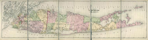
Last week, the New York Public Library released twenty thousand maps from its extensive collection, which includes more than four hundred thousand sheets and twenty thousand books and atlases, as free, high-resolution digital downloads. In announcing the newly accessible maps, the N.Y.P.L explained that the holding includes more than a thousand maps of New York City from the seventeenth century to the twentieth century, “which detail transportation, vice, real estate development, urban renewal, industrial development and pollution, political geography among many, many other things.” Continue reading