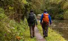
The Slow Ways founder, Daniel Raven-Ellison (right) walks with the Guardian’s Patrick Barkham as they verify a route between Congleton and Macclesfield. Photograph: Fabio De Paola/The Guardian
The right of way is a theme we love, and now there is a technology to assist our pursuit of those rights, at least in one country.
Our thanks to and the Guardian for their coverage of this development:
Walk the walk: the app mapping 140,000 miles of public right of way
Slow Ways was set up during the pandemic when frustrated locked-down walkers drew up more than 9,000 walking routes across Great Britain. Photograph: Fabio De Paola/The Guardian
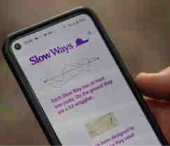
Community-based, Slow Ways has verified 60% of a network of pedestrian-friendly routes across Great Britain
I meet up with Daniel Raven-Ellison, the brains behind the Slow Ways walking network, in the darkness of a drizzly dawn at Kidsgrove railway station in Staffordshire. Our mission? To walk and verify the final 17-mile (27km) link in the route between Birmingham and Manchester.
Steady drizzle falls as we head north beside another slow way – the Trent and Mersey canal. “You can walk from Godalming [Surrey] to Kendal [Cumbria] on canals,” says Raven-Ellison. “We’ve got this ready-made national trail and there’s no signage to invite you to do that … Kingfisher!”
He interrupts himself to point: above the stormy brown water dash two kingfishers, dazzling the day with their iridescent turquoise and ginger. This is, after all, part of the joy of walking. “Slow Ways is not just a walking network,” says Raven-Ellison. “It’s a network for all the things that walking gives us – making us healthier, happier, more productive, more creative and more relationship-rich. It is also lower carbon and better for the environment.”
Slow Ways is a community-created, peer-reviewed national network of pedestrian-friendly routes linking towns, cities and national parks. Raven-Ellison, a former teacher, national park cities founder and a person who seemingly generates a big idea every seven seconds, came up with the idea of using citizen mapping to create a national network of paths so people could walk between towns and cities one day when he began a walk from Winchester to Salisbury and his destination was not signposted on any paths…
Read the whole article here.
